The High Falls (http://en.wikipedia.org/wiki/High_Falls_(Rochester,_New_York)) of the Genesee River in downtown Rochester. This 96 foot high waterfall is the reason Rochester exists. As evidenced by the foundations and structures around the falls, these falls provided energy for early industrial facilities.
Genesee Brewing Company (Genny) (http://www.geneseebeer.com/) overlooking the High Falls. Someone told me recently that the new paint job reminds them of Santa's Village. It is really festive this season with all the snow and all.
A view of the High Falls/Brown's Race District (http://en.wikipedia.org/wiki/Brown's_Race_Historic_District) and downtown.
RGE power station to the northwest of the High Falls with the Kodak Headquarters in the background. This station is still in operation using coal, gas, oil, and hydroelectric power, but is scheduled to be demolished after 120+ years in use. There's great potential for redevelopment/natural rehabilitation in this area.
Panorama of the High Falls with downtown Rochester in the background.
A close up of the High Falls.
Pont de Rennes (http://en.wikipedia.org/wiki/Pont_De_Rennes_bridge) over the Genesee River Gorge. It use to be a street bridge before being converted to a pedestrian bridge. It provides the best view of the High Falls
A view of the Pont de Rennes bridge looking toward the northwest.
A close up of the High Falls. The pavilion to the top right of the falls is a viewing area for the falls. To the left is a railroad bridge with supports in front of it. Rumor has it that a pedestrian bridge will be built there in the near future. A great idea to complete a High Falls Loop trail. It will also provide better access to downtown and improve the Genesee Riverway Trail (http://www.cityofrochester.gov/grt/).
Phoenix Mill Building (http://www.communitywalk.com/location/flour_milling_phoenix_mill/info/2981412) at the base of the Pont de Rennes Bridge. It's kind of a strange building because it's been burned down, replace, destroyed, restored so many times. It's a mutant of a building with lots of different building materials and styles.
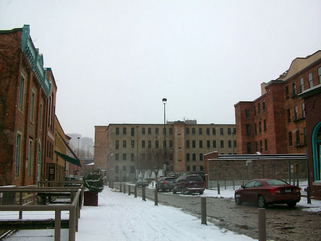
A view of the Brown's Race District looking southeast of Browns Race Street. To the left, you will see little bridges between the buildings and street. This was once a water raceway that provided hydroelectric power to many of the structures. There are plans to convert this into a sunken garden. Plans can be viewed at: https://ioby.org/project/sustainable-sunken-garden-browns-race
Victorian Rochester Water Works Building with the raceway in front.
Brown's Race Market. It's a converted maintenance building with a view of the High Falls gorge. Again, with the raceway in front.
Once home to the Rochester Button Company on State Street. They were the Apple Computers of buttons back in the day.
High Falls Business Center (http://www.highfallsbizcenter.com/)
This building on Mill Street is my dream building. I've always wanted to own a building like this, live upstairs, and run a business on the first floor.
This was once a paper box factory.
The Stantec Building (http://www.stantec.com/) was once a powerhouse for the New York Railway Company.
To find out more about the High Falls/Browns Race area, you should check out: http://gardenaerial.org/ They are doing great work with developing trails, gardens, festivals, and sooooooooooooo much more.
To find out more about the High Falls/Browns Race area, you should check out: http://gardenaerial.org/ They are doing great work with developing trails, gardens, festivals, and sooooooooooooo much more.
I recently drove up State St/Lake Ave and was surprised at how intact the neighborhoods are and the quality of architecture. Seems ripe for a north/south street car line between Ontario Beach Park/Charlotte-downtown-U of R/Marketplace Mall/RIT.
Kodak Tower (http://en.wikipedia.org/wiki/Kodak_Tower). George Eastman moved his business here on State Street from a previous location in 1882. The first 16 stories of the main structure was constructed in 1914 and the top added in 1930. It has been surrounded and encased with a series of unfortunate buildings since.
What is that off in the distance? It's Frontier Field baseball stadium (http://www.frontierfield.org/) (or outdoor hockey arena this week). It's unfortunate that they located the stadium in the back along the highway and parking in the front near all the activity. This really undermines the whole purpose of using a stadium to generate economic activity for the area. This lot should be replaced with something like Patriots Place in Foxborough (http://www.patriot-place.com/) or Wrigleyville (http://www.chicagotraveler.com/neighborhoods/wrigleyville-feature.htm) in Chicago. Obviously, on a smaller scale. Removing or boulevard-izing the Inner Loop would go a long way to improving the area. Better connections to the Susan B. Anthony Neighborhood, which is cut off by 490 would also be mutually beneficial.
Heading back to downtown. Here's a building that is a part of the State Street Historic District (http://en.wikipedia.org/wiki/State_Street_Historic_District_(Rochester,_New_York)).
Column of the First National Bank of Rochester-Old Monroe County Savings Bank (http://en.wikipedia.org/wiki/First_National_Bank_of_Rochester-Old_Monroe_County_Savings_Bank_Building) on State Street.
Wilder Building (http://en.wikipedia.org/wiki/Wilder_Building) on Main and Exchange.
Reynolds Arcade Building (http://en.wikipedia.org/wiki/Reynolds_Arcade) on Main Street. Another great Art Deco building downtown.
A view west from Aqueduct Park.
Rundel Memorial Library (http://en.wikipedia.org/wiki/Rundel_Memorial_Library)
Court Street Bridge (http://en.wikipedia.org/wiki/Court_Street_Bridge_(Genesee_River)). Rochester has a great collection of bridges downtown within walking distance. The San Antonio River Walk (http://www.thesanantonioriverwalk.com/) could be inspiration.
Flood control dam near Court Street.
"U Look So Good Today." Finally, graffiti that makes you feel good about yourself.
The Broad Street Bridge (http://en.wikipedia.org/wiki/Broad_Street_Bridge_(Rochester,_New_York)). The first level was originally constructed as an aqueduct to cross the Genesee River (http://en.wikipedia.org/wiki/Genesee_River) for the Erie Canal (http://en.wikipedia.org/wiki/Erie_Canal). The second level was added about 90 years later for car traffic. When the Erie Canal was re-routed, the aqueduct was repurposed as a subway. The subway was shut down in 1956, leaving this portion abandoned.
A view of the Broad Street Bridge from the War Memorial at Blue Cross Arena (http://www.bluecrossarena.com/)/Civic Center Complex/Festival Grounds. on the west side. On the other side is the Rundel Memorial Library/Rochester Riverside Convention Center (http://www.rrcc.com/)/hotels. This could be the centerpiece of a river walk system. It provides tons of connections with a historic and interesting location.
The interior of the Broad Street Bridge Aqueduct.
This was the former bed of the Erie Canal through downtown Rochester. It's amazing how light this space is. I'm imagining Millennium Station (http://en.wikipedia.org/wiki/Millennium_Station) in Chicago.
Crossing the uninteresting top of the Broad Street Bridge (mentioned earlier) heading to the Bausch and Lomb Place (http://www.bausch.com/) (tall building in the center) (http://en.wikipedia.org/wiki/Bausch_&_Lomb_Place). Not sure about the long term future of this Rochester institution since they were recently purchased by another company that seems determined to leave the area.
Bausch and Lomb Atrium.
Interior of the Bausch and Lomb Atrium all decorated for the holidays. Postmodern design and a fairly active space at lunchtime.
Another view of the interior of the atrium. I didn't add the twinkling lights or know how to make them stop. But, enjoy...
A section of the Berlin Wall in the atrium of Bausch and Lomb.
A view of the Broad Street Bridge from the War Memorial at Blue Cross Arena (http://www.bluecrossarena.com/)/Civic Center Complex/Festival Grounds. on the west side. On the other side is the Rundel Memorial Library/Rochester Riverside Convention Center (http://www.rrcc.com/)/hotels. This could be the centerpiece of a river walk system. It provides tons of connections with a historic and interesting location.
Another exterior view of the bridge. The automobile section should be upgraded as a part of any renovation. The top looks like just an other boring bridge. Some landscaping, railing work, pedestrian amenities, and lighting could go a long way.
This was the former bed of the Erie Canal through downtown Rochester. It's amazing how light this space is. I'm imagining Millennium Station (http://en.wikipedia.org/wiki/Millennium_Station) in Chicago.
Crossing the uninteresting top of the Broad Street Bridge (mentioned earlier) heading to the Bausch and Lomb Place (http://www.bausch.com/) (tall building in the center) (http://en.wikipedia.org/wiki/Bausch_&_Lomb_Place). Not sure about the long term future of this Rochester institution since they were recently purchased by another company that seems determined to leave the area.
Bausch and Lomb Atrium.
Interior of the Bausch and Lomb Atrium all decorated for the holidays. Postmodern design and a fairly active space at lunchtime.
Another view of the interior of the atrium. I didn't add the twinkling lights or know how to make them stop. But, enjoy...
A section of the Berlin Wall in the atrium of Bausch and Lomb.
This probably concludes my roaming of downtown Rochester for now. My jury duty is at an end. But, if you are interested in seeing more, please visit my previous visits at:
Rochester
Rochester
